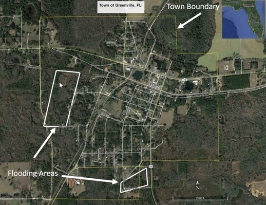
The City of Greenville, FL, located 44 miles east of Tallahassee, FL, requested for USACE to help address its flooding issue and reduce future risk while avoiding negative impacts to the surrounding area. This FPMS study offered technical assistance efforts to determine site-specific data on obstructions to flood flows, formation, and timing; flood depths, stages, or stages, or floodwater velocities; and flooding extent, duration, and frequency. Natural and cultural floodplain resources were collected to inform a preliminary flood loss analysis with and without the use of floodplain management measures.
The FPMS study report included a conceptual-level analysis of the best performing flood risk management plan and compared these to potentially feasible local solutions. The analysis supported the development of risk management measures to mitigate risk to residences and businesses, as well as reduce impacts to the natural resources with the project areas. The findings resulted in one plan made up of several flood risk management measures which was selected as the potentially feasible local solution under the extent of the report’s authority and purpose. The report is not associated with a federal action to implement the findings. BACK