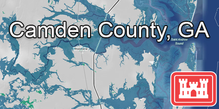
 This innovative analysis utilized Coastal Hazard System (CHS) data to generate water surface grids for the 10% and 1% Annual Exceedance Probability events for Camden County based on NOAA Intermediate High Sea Level Rise projections for the years 2050, 2075, and 2100. Inundation layers were intersected with infrastructure data provided by Camden County and sourced from national-level datasets to assess potential future impacts to infrastructure. The Nature Conservancy led Camden County Resiliency Implementation Workplan will be utilizing this dataset in their prioritization tool to support risk and project ranking. BACK